Land survey companies in Qatar provide the measurements and geographical information required for property development, infrastructure and construction. Their work helps establish land boundaries, map existing site conditions and position new structures correctly.
An inaccurate survey can cause serious problems. A building may be positioned outside its approved limits, underground utilities can be damaged, or earthwork quantities may be calculated incorrectly. Professional surveying therefore plays an important role from the first design drawing through to final handover.
This guide focuses on companies with verifiable land, cadastral, topographic, construction or utility-surveying capabilities in Qatar. Quantity-surveying consultancies have not been included because their work primarily concerns construction costs rather than physical land measurement.
The companies are presented in an editorial order based on service range, professional standing, local experience and available evidence of technical capability. The list is not an official ranking.
1. STS Survey Technologies
STS Survey Technologies is one of the most comprehensive land survey companies in Qatar. Established in Doha in 2015, it describes itself as a Class A surveying company officially registered by the Ministry of Municipality and Environment.
Its services include cadastral surveys, topographic mapping, construction setting-out, underground utility detection, geographic information systems and monitoring.
STS also uses ground-penetrating radar to help locate buried cables, pipelines and other underground features. Its 3D and geospatial capabilities make it suitable for traditional land surveys as well as data-intensive construction and infrastructure assignments.
Why it stands out:
- Class A surveying company
- Cadastral and boundary surveys
- Topographic site mapping
- Construction setting-out
- Underground utility detection
- Geographic information systems
Best suited for: Property boundaries, building plots, infrastructure, construction control and projects requiring authority-ready survey information.
2. Concord Surveying Works
Concord Surveying Works was founded in 1997, giving it one of the longest documented operating histories among specialist land survey firms in Qatar.
The company provides topographic, cadastral, boundary, GPS, geodetic and construction surveys. Its technology-based services also include aerial mapping, drones, LiDAR, geographic information systems and 3D laser scanning.
This combination of conventional surveying and modern digital measurement allows Concord to support property owners, architects, contractors and infrastructure developers.
Why it stands out:
- Operating since 1997
- Cadastral and boundary surveying
- GPS and geodetic surveys
- UAV and LiDAR mapping
- 3D laser scanning
- Local regulatory knowledge
Best suited for: Land registration, property development, large topographic surveys and digital mapping.
3. Vertex Engineering
Vertex Engineering is a Qatar-based company specialising in survey engineering, LiDAR, geographic information systems, 3D laser scanning and Building Information Modelling.
Its surveying division undertakes topographic surveys, construction setting-out, measured building surveys, structural monitoring, underground utility detection and high-precision engineering surveys.
Vertex says it can establish site control using local or national coordinate grids and achieve millimetre or sub-millimetre accuracy for suitable engineering assignments.
The company has also provided surveying services on major developments associated with Doha Metro.
Why it stands out:
- High-precision engineering surveys
- Topographic and construction services
- LiDAR and 3D laser scanning
- Underground utility surveys
- Scan-to-BIM capabilities
- Experience on major transport projects
Best suited for: Railways, infrastructure, complex buildings, deformation monitoring and projects requiring detailed digital models.
4. Al Shabeeb Surveying
Al Shabeeb Surveying is an engineering and surveying firm operating in Qatar.
Its services include cadastral, topographic and construction surveys. The company also provides hydrographic surveying, making it suitable for projects that extend from land into coastal or marine environments.
Al Shabeeb reports certification under ISO 9001, ISO 14001 and ISO 45001 standards, covering quality, environmental and occupational health and safety management.
Why it stands out:
- Cadastral surveying
- Construction surveys
- Topographic mapping
- Hydrographic capabilities
- ISO-certified management systems
- Engineering-survey expertise
Best suited for: Property, construction, infrastructure and developments requiring both land and marine measurements.
5. Compass Arabia
Compass Arabia provides surveying, geotechnical and digital engineering services across Qatar and other Gulf markets.
The company undertakes commercial land surveys, construction-site surveys, 3D scanning, precision mapping and ground investigations. It serves clients in infrastructure, construction, oil and gas and the public sector.
Its combination of surface measurement and geotechnical investigation is useful for projects that need both an accurate topographic model and information about underground soil or rock conditions.
Why it stands out:
- Commercial land surveying
- 3D scanning and precision mapping
- Construction surveys
- Geotechnical investigations
- Infrastructure experience
- Regional operations
Best suited for: Industrial sites, infrastructure corridors, large buildings and projects combining surveying with ground investigation.
6. Galaxy Engineering Consulting Company
Galaxy Engineering Consulting Company provides specialised surveying services and trained survey crews for projects in Qatar.
Its services include right-of-way surveys for highways, railways and pipelines. It also undertakes ground-control surveys for aerial photogrammetry, settlement monitoring, deformation surveys and earthwork-volume calculations.
The company can prepare easements and provide technical surveying support for legal disputes involving land or measured quantities.
Why it stands out:
- Highway and railway surveys
- Pipeline right-of-way surveys
- Settlement and deformation monitoring
- Earthwork-volume calculations
- Aerial-survey ground control
- Easement preparation
Best suited for: Transport corridors, pipelines, major earthworks and infrastructure developments.
7. Red Link Trading and Contracting
Red Link is a Qatar-registered company specialising in precision land surveying, 3D laser scanning and technical staffing.
The company says it has operated since 2018 and has served more than 100 clients across construction, infrastructure, government and oil and gas.
Its staffing capability may benefit contractors that require survey teams to remain on a project for an extended construction period rather than complete a single measurement assignment.
Why it stands out:
- Qatar-registered survey business
- Precision land surveys
- 3D laser scanning
- Construction-sector experience
- Survey-staff secondment
- Government and industrial clients
Best suited for: Construction projects, infrastructure, industrial facilities and contractors requiring dedicated site surveyors.
8. Digital Contracting and Services
Digital Contracting and Services provides land surveying, as-built surveys, GPS control surveys, utility mapping and CAD drawing preparation.
The company says it is accredited by Qatar’s Ministry of Municipality to provide surveying and contracting services. It also reports more than 10 years of experience supporting construction clients.
Its published equipment includes GPS systems and total stations from established surveying-equipment manufacturers.
Why it stands out:
- Ministry-accredited operations
- Land and as-built surveys
- GPS control networks
- Utility-location surveys
- CAD drawing preparation
- Construction-sector experience
Best suited for: Construction setting-out, as-built documentation, utility mapping and GPS control work.
9. ACES
ACES maintains a land and marine surveying division with experience in topographic surveys, construction setting-out and underground utility detection.
Its capabilities also include settlement monitoring, earthwork-volume calculations, hydrographic surveys and bathymetric mapping.
The company says its operations are supported by in-house equipment, specialist software and qualified survey engineers.
Why it stands out:
- Land and marine surveying
- Topographic mapping
- Underground utility detection
- Settlement monitoring
- Earthwork-volume surveys
- In-house technical resources
Best suited for: Large construction sites, coastal developments, excavation monitoring and projects combining land and marine surveying.
10. EIWAA Oil and Gas Services
EIWAA provides land-surveying and underground utility-mapping services in Qatar.
Its capabilities include geodetic surveys, cadastral surveys, topographic mapping, construction surveys and ground-penetrating radar. The company also undertakes geographic surveys for commercial and oil-and-gas clients.
Its utility-detection capabilities are particularly relevant where excavation will take place in areas containing existing pipes, cables or industrial services.
Why it stands out:
- Geodetic and cadastral surveys
- Topographic mapping
- Construction surveying
- Ground-penetrating radar
- Underground utility mapping
- Oil-and-gas experience
Best suited for: Industrial sites, utility corridors, construction projects and developments requiring subsurface mapping.
11. Al Rashid Trading and Contracting
Al Rashid Trading and Contracting provides geographic information system and land-surveying services alongside its wider engineering operations.
Its services include setting-out work, transferring approved map information onto the ground and supporting utility-network projects.
The company’s experience in wet and dry utilities can help where surveying is required for water, electricity, sewerage or telecommunications infrastructure.
Why it stands out:
- Land-surveying services
- GIS survey solutions
- Construction setting-out
- Utility-sector experience
- Engineering and contracting support
Best suited for: Utility networks, infrastructure, setting-out and projects requiring combined survey and contracting knowledge.
12. Surtech International
Surtech International provides specialised surveying services in Qatar, including topographic and construction surveys.
Its capabilities also include GPS positioning, dimensional-control surveys and 3D laser scanning. Dimensional control is especially valuable on industrial and mechanical projects where components must fit together within very tight tolerances.
The firm’s technical profile indicates access to specialist survey-processing and civil-engineering software.
Why it stands out:
- Topographic and construction surveys
- GPS positioning
- Dimensional control
- 3D laser scanning
- Specialist processing software
- Industrial survey capabilities
Best suited for: Industrial construction, complex structures, dimensional verification and high-accuracy engineering work.
13. Grand Arab Trading and Contracting
Grand Arab Trading and Contracting provides land-surveying services for construction and development projects in Qatar.
Its surveying operations are positioned around the accurate measurement and documentation required for project planning and execution.
As surveying forms part of a wider contracting business, it may suit clients looking for measurement support within a broader construction package.
Why it stands out:
- Construction land surveys
- Development-project support
- Integrated contracting services
- Site-measurement capabilities
- Locally focused operations
Best suited for: Small and medium construction projects requiring general land-surveying support.
What Services Do Land Survey Companies Provide?
Cadastral surveys
A cadastral survey establishes and records information about land parcels. It is used in land administration, property registration and subdivision.
Boundary surveys
Boundary surveys identify or confirm the limits of a property using available plans, records and physical survey evidence.
Topographic surveys
A topographic survey records land levels and visible features such as buildings, roads, walls, trees and drainage structures.
Construction setting-out
Setting-out transfers positions, dimensions and elevations from approved drawings to the construction site.
As-built surveys
An as-built survey records where structures and services were actually installed. It is commonly required during inspections and project handover.
Engineering surveys
Engineering surveys provide precise control for bridges, roads, railways, industrial structures and other technically demanding projects.
Underground utility surveys
Surveyors use detection equipment and existing records to locate buried cables, pipes and drainage infrastructure.
Deformation monitoring
Repeated measurements determine whether a structure, excavation or surrounding ground is moving over time.
Earthwork-volume surveys
Measurements taken before and after excavation are used to calculate quantities of soil or rock removed, filled or stockpiled.
3D laser scanning
Laser scanners capture millions of points to create a detailed digital representation of a site, building or structure.
UAV and drone surveys
Drones can collect aerial images and measurements over large or difficult-to-access sites. Appropriate permissions are required before drone operations.
How We Selected the Best Land Survey Companies
The companies were assessed using factors relevant to professional land surveying:
- Clear evidence of operations in Qatar
- Cadastral, topographic or construction-survey capabilities
- Professional registration or stated authority accreditation
- Use of modern surveying technology
- Experience in property, construction or infrastructure
- Range of deliverables
- Availability of specialised services such as utility detection
- Evidence of local project experience
Clients should still verify current registrations and professional credentials before making an appointment.
How to Choose a Land Survey Company in Qatar
Identify the survey you require
A boundary survey, topographic survey and construction setting-out assignment have different scopes. Define the intended use before requesting quotations.
Check registration and approval
Confirm that the firm and proposed surveyor are authorised to undertake the required work. Surveys intended for official submission may have additional requirements.
Qatar’s Centre for Geographic Information Systems is the country’s official geospatial agency, while the Ministry of Municipality manages land-related and survey services.
Review similar projects
A survey company experienced in villas may not have the staffing or equipment required for a highway, industrial plant or metro project.
Confirm the coordinate system
The survey proposal should identify the coordinate reference, vertical datum and control points to be used.
Agree on accuracy
The required tolerance should be written into the scope. General topographic mapping and high-precision structural monitoring require different levels of accuracy.
Examine the equipment
Depending on the assignment, equipment may include:
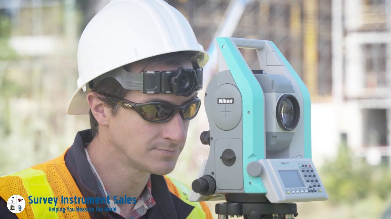
- Total stations
- GNSS receivers
- Digital levels
- 3D laser scanners
- Ground-penetrating radar
- Electromagnetic utility locators
- Drones and aerial cameras
Define the deliverables
Confirm whether the survey company will provide CAD drawings, PDF plans, coordinate lists, point clouds, digital terrain models, BIM files or written reports.
Ask about quality checks
A professional company should explain how measurements, calculations and drawings are independently verified before delivery.
Consider professional insurance
For substantial assignments, ask whether the firm maintains professional-indemnity and public-liability insurance.
Questions to Ask Before Hiring a Land Surveyor
- Is the firm registered for the required survey?
- Has it completed similar work in Qatar?
- Who will lead the assignment?
- Which equipment will be used?
- Which coordinate and elevation system will apply?
- What accuracy will be achieved?
- Are existing control points available?
- Does the fee include authority submission?
- Which digital and printed deliverables are included?
- How will underground utilities be identified?
- How long will fieldwork and reporting take?
- How are errors or missing information handled?
How Much Does a Land Survey Cost in Qatar?
There is no standard price that applies to every land survey. Fees depend on:
- Plot or project size
- Type of survey
- Required accuracy
- Number of survey points
- Site accessibility
- Existing buildings and obstructions
- Underground utility detection
- 3D scanning or drone requirements
- Authority submission
- Drawing and modelling requirements
- Urgency of the assignment
A simple residential topographic survey will generally require fewer resources than an infrastructure corridor, industrial facility or detailed 3D scan.
The lowest quotation may exclude control establishment, utility detection, official submission or digital deliverables. Clients should compare the complete scope rather than the headline fee.
Frequently Asked Questions
Which are the best land survey companies in Qatar?
STS Survey Technologies, Concord Surveying Works, Vertex Engineering and Al Shabeeb Surveying are among the most comprehensive firms for land and engineering surveys.
What is the difference between a land surveyor and a quantity surveyor?
A land surveyor measures physical positions, levels and property boundaries. A quantity surveyor manages construction costs, payments and contracts.
Do I need a survey before building?
A topographic and boundary survey is commonly required before design and construction. Setting-out is then needed to position the approved building correctly.
Can a surveyor confirm legal ownership?
A surveyor can measure and document a property boundary, but legal ownership is established through official title and land-registration records.
Can surveyors locate underground utilities?
Specialist firms can use records, electromagnetic detection and ground-penetrating radar to identify probable utility locations. Trial excavations may still be required before construction.
What is an as-built survey?
An as-built survey records the final location and elevation of completed structures or services. It shows whether the work matches the approved design.
How long does a land survey take?
Timing depends on the site’s size, complexity, accessibility and required deliverables. Simple plots may take a short period, while large infrastructure surveys can require several weeks or ongoing site attendance.
Final Thoughts
The best land survey companies in Qatar combine local knowledge with modern measurement technology and effective quality-control systems.
STS Survey Technologies offers a particularly broad range of registered land and geospatial services. Concord Surveying Works brings a long operating history, while Vertex Engineering stands out for high-precision surveys, 3D scanning and digital modelling.
Al Shabeeb, Compass Arabia and Galaxy Engineering are also strong options for construction and infrastructure work. The right choice depends on whether the project requires cadastral, topographic, construction, utility or high-precision engineering surveying.
Before appointing a firm, verify its current registration, proposed surveyor, equipment, accuracy standards and experience with comparable projects.
Read Also: The Best Bridge Contractors in Qatar